




The Le Pouce hike in Mauritius takes 1 hour 15 minutes to 1 hour 45 minutes of walking to reach the summit of the island’s third-highest mountain, at 812 metres. Two routes lead to the top, with no guide required, offering 360° views over the city, its harbour, Pieter Both and the lagoon. Our concierges at Legend Hill recommend it to regular hikers. Here is everything you need to know about the difficulty level, actual duration, practical tips and equipment to bring.
Le Pouce rises to 812 metres, making it the third-highest peak in Mauritius, after Piton de la Petite Rivière Noire (828 metres) and Pieter Both (820 metres). Its distinctive silhouette, resembling a basalt finger rising above the capital, gave it its name and makes it visible from a great distance. The mountain belongs to the Moka Range, a volcanic ridge running through the north-central part of Mauritius.
The site also has an important scientific history. Charles Darwin climbed Le Pouce on 2 May 1836, during the Beagle’s stopover in Port Louis, as reported by Le Défi Media Group. From the summit, the view stretches across the harbour, the sugar cane fields of the central plateau and the Indian Ocean.
Two trails lead to Le Pouce, and the route you choose makes a significant difference to the level of effort required. Here is how to choose between them before setting off into the mountains.
This route starts from a car park at an altitude of 381 metres, which significantly reduces the amount of climbing required. According to the route description published by Visorando, the trail covers 3.7 km with 402 metres of elevation gain and is rated as moderate. The path crosses a meadow before reaching a mountain pass and then tackling the final ascent.
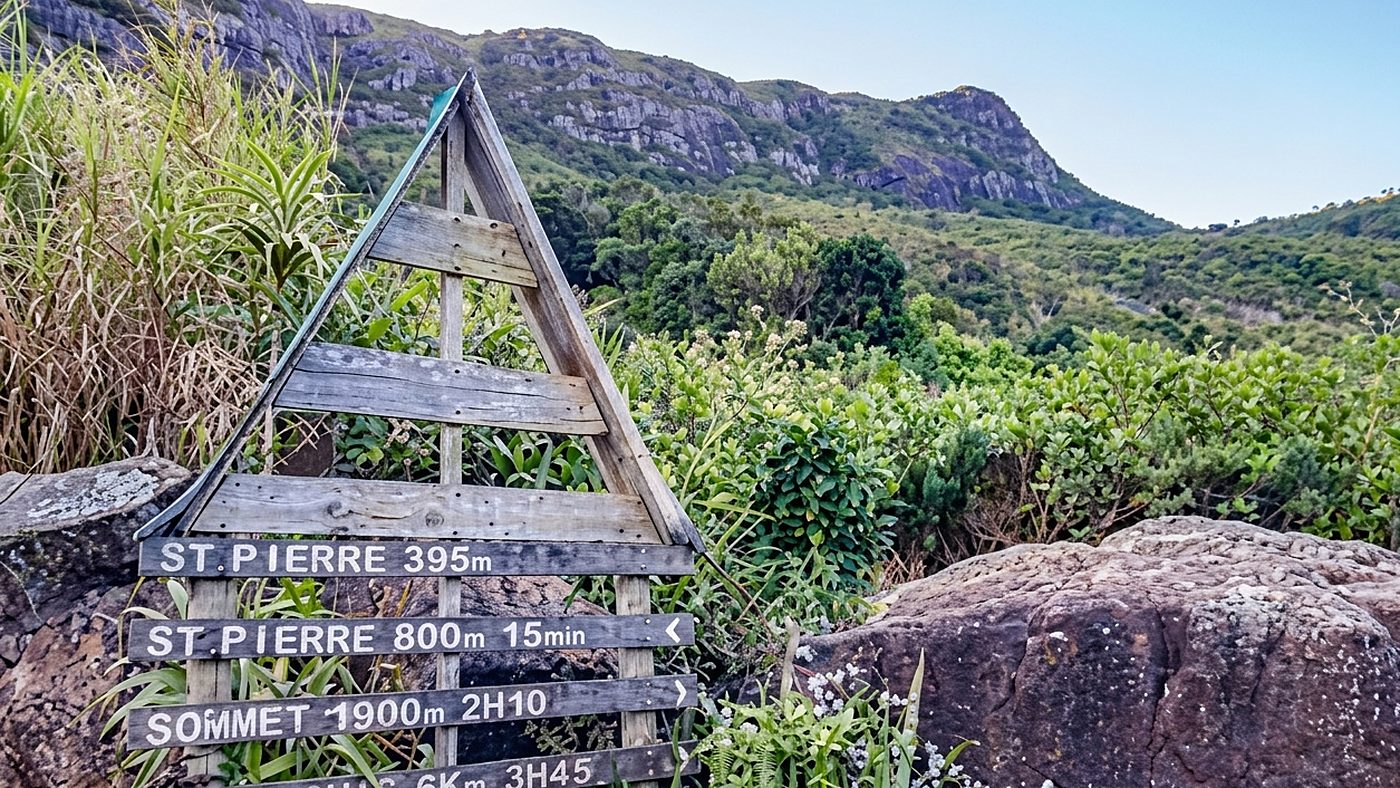
The second route starts south of the city, around Tranquebar. This hike roughly doubles the distance and elevation gain, as it begins almost at sea level. This option is best suited to experienced hikers, as the heat is more intense at lower altitudes.
The final section beneath the summit rock sometimes requires you to use your hands for a few metres. It is not technically difficult, but the rocks can become slippery after rainfall. Our team recommends setting off around 7 a.m.: the low morning light still highlights the ridges, mist has not yet risen over the plateau and the rocks have had time to dry overnight.
The dry season, from May to October, generally offers the best conditions: clear air, firm ground and more comfortable temperatures. By contrast, the southern summer brings short showers that can make the volcanic soil slippery. A reasonable level of fitness is sufficient, provided you are used to walking regularly. Before setting off, here are our practical tips:
From our estate in Rivière Noire, the Legend Hill concierge team can arrange your transfer, guide and excursions adapted to your hiking level.
This hike takes up half a day, leaving plenty of time to continue exploring the area. Port Louis lies just below: its Central Market, waterfront and colonial buildings are among the must-see attractions in Mauritius. The proximity between the trailhead and the city helps explain why this hike is so popular with travellers short on time.
The neighbouring mountain range offers other adventures, starting with Pieter Both and its balancing rock, which is reserved for experienced climbers. For photography enthusiasts, the summit offers the best views over the harbour at sunrise. For children who are used to walking for two hours, the shorter route remains the only sensible option.
Many of our guests hesitate between Le Pouce and Le Morne. We recommend Le Pouce first: the climb is gentler, and the views over both sides of the island are always a pleasant surprise.
Looking for a place from which to explore Mauritius’s finest hiking trails without giving up comfort? Book your stay at Legend Hill in one of our private villas for rent: our concierges can create a personalised experience, from your transfer to your pre-hike breakfast.
Fancy climbing Le Pouce at first light?
Method: the distance, elevation gain and difficulty of the Moka route were taken from the Visorando trail description, Darwin's ascent on 2 May 1836 was verified in the Défi Media Group article, the seasons and weather conditions come from the Mauritius Meteorological Services, and the real walking times and field advice were supplied by the Legend Hill team, verified in September 2026. The ground becomes slippery after showers: the state of the trail matters more than the calendar.
Twenty-three years in luxury hospitality and international cruising, from Heritage Golf & Spa Resort to SO/ Mauritius, by way of Club Med 2 and Cunard: Dinesh Doorbeejan joined Legend Hill as Head Concierge. Butler, Head Butler then Duty Manager, he took part in several hotel opening teams before building the resort’s concierge department and training its staff. He is the one who designs guests’ tailor-made itineraries across the island.