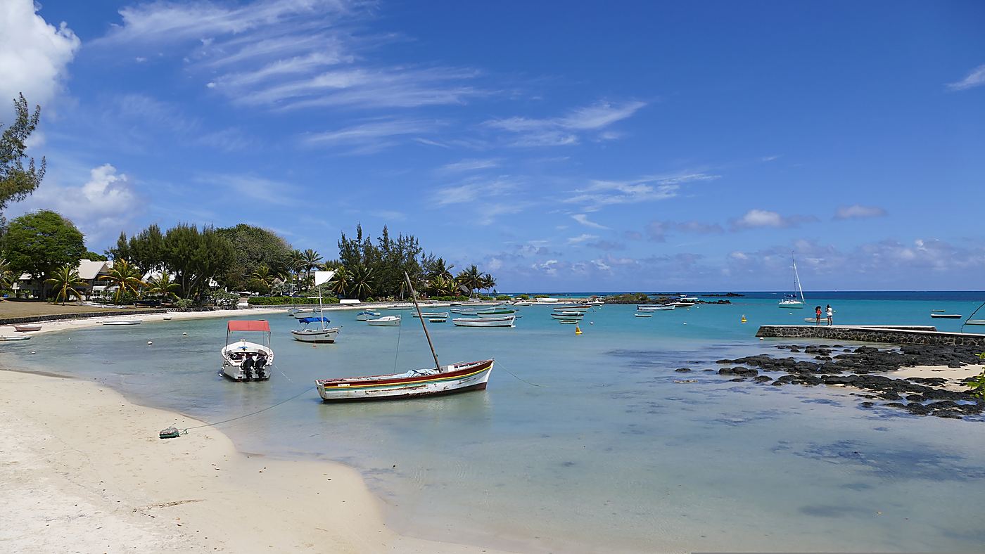
Location: the northernmost tip of Mauritius, facing the Indian Ocean.
Signature: a white chapel with a scarlet roof, consecrated on 7 August 1938.
View: Coin de Mire in the foreground, followed by Flat Island, Gabriel Island and Round Island.
Origin of the name: shipwrecks on the reefs and the British landing of 1810.
Atmosphere: a fishing village, with beached pirogues and a small sandy beach.
Access: approximately 1.5 hours by road from Rivière Noire, on the west coast.
Cap Malheureux, Mauritius, lies at the northernmost tip of the country. This fishing village is renowned for Notre-Dame Auxiliatrice Chapel, inaugurated on 7 August 1938, whose scarlet roof stands out against the blue lagoon. Offshore, the distinctive sloping silhouette of Coin de Mire closes the horizon, 8 km from the coast. Our concierges at Legend Hill, a luxury hotel in Mauritius, recommend that guests visit at the end of the day. Here is the history of the site, its panoramic views and the local customs worth knowing.
The red-roofed church, the village’s signature landmark
Notre-Dame Auxiliatrice gives the village its most recognisable silhouette: white walls, exposed timber framework, a carved-stone altar and a striking red roof facing the sea. The chapel was designed by Max Boullé and built by Raoul Lolliot, at the initiative of Father Albert Glorieux, a Belgian missionary then parish priest of Saint-Michel de Grand-Gaube. It was consecrated on 7 August 1938.
The sanctuary remains an active place of worship and is open to visitors outside religious services. Its real appeal, however, lies in its setting: behind the bell tower, the Indian Ocean fills the entire horizon. It is this view, more than the architecture itself, that has made the building one of the most widely photographed images of Mauritius.
◆ Our favourite time
Visit in the late afternoon. The low sunlight warms the colour of the roof, fishermen pull their pirogues up onto the sand, and the offshore landscape stands out clearly against the horizon. This is the time our guests most often choose for photographs.
— Kareena Seecharan, Concierge Officer, Legend Hill
Why does this cape have such a gloomy name?
The name Cap Malheureux refers to shipwrecks that occurred on the reefs just offshore, which were particularly treacherous for sailing vessels. This exposed headland, subject to winds and currents, was long considered one of the most feared points along the Mauritian coast.
A second episode sealed the site’s reputation. On 29 November 1810, British troops landed here before advancing towards Port Louis. The French surrender came a few days later, bringing French rule on the island to an end. This quiet village therefore witnessed a turning point in the history of Mauritius in less than a week.
What can you do in Cap Malheureux and the surrounding area?
Allow half a day in Cap Malheureux, enough time to see the village in action. Buy fresh fish as the pirogues return, have lunch at a seaside shack, and leave with a piece of jewellery made before your eyes. In between, you can simply walk out into the lagoon, which remains shallow enough to allow you to wade a considerable distance towards the open sea.
Once you have explored the village, the entire north is within easy reach: a few minutes by car or boat is all it takes.
Admire Coin de Mire from the seawall: this sloping islet, 8 km offshore, forms a 76-hectare nature reserve listed in the World Database on Protected Areas.
Head to nearby Bain Bœuf Beach for a swim in shallow waters.
Continue to Anse la Raie, where the flat water attracts kitesurfing enthusiasts.
Depart from Grand Baie, just a few minutes away by car, for Flat Island and Gabriel Island: catamaran trips serve these two protected destinations on day outings.
Book a snorkelling trip from the same location, with the reefs lying beyond the lagoon.
◆ A word from our concierge team
Our guests often combine Cap Malheureux with a boat trip to Gabriel Island: a morning on the water, lunch on the way back, and then the church in the evening light. That is the order that works best.
— Dinesh Doorbeejan, Head Concierge, Legend Hill
Getting to Cap Malheureux from the west coast
Allow approximately 1.5 hours to travel from Rivière Noire to the northern tip of Mauritius, covering around 68 km via the Terre Rouge–Verdun–Trianon Link Road. The route crosses the central plateau before descending towards Grand Baie. From our Legend Hill estate, perched on the heights of La Tourelle, our concierge team can arrange this excursion as a full-day outing.
This format leaves enough time to combine a boat trip, lunch overlooking the lagoon and a visit to the sanctuary in the late afternoon. Our concierges can arrange the transfer, boat booking and return journey, so you do not have to drive.
Would you like to discover northern Mauritius without giving up the tranquillity of the west coast? Book your stay at Legend Hill: our concierges can plan your day in Cap Malheureux, from departure to your return at sunset.
Yes, swimming is possible at Cap Malheureux, but the small village beach is primarily used as an anchorage for fishing pirogues. For a more comfortable swim, head instead to Bain Bœuf, just a few minutes away by car, where the shallow, sheltered waters are particularly suitable for families.
Who built the church at Cap Malheureux? +
Notre-Dame Auxiliatrice Chapel was designed by Max Boullé and built by Raoul Lolliot, at the initiative of Father Albert Glorieux, a Belgian missionary then parish priest of Saint-Michel de Grand-Gaube. It was consecrated on 7 August 1938 and remains an active place of worship.
Can you visit the red-roofed church? +
Notre-Dame Auxiliatrice welcomes visitors outside religious services, as it remains an active place of worship. Wear clothing that covers your shoulders and knees, and remain quiet inside. The interior can be explored quickly: white walls, exposed timber framework and a carved-stone altar.
Which islets can be seen from Cap Malheureux? +
From Cap Malheureux, Coin de Mire dominates the foreground with its distinctive sloping profile, 8 km from the coast. On a clear day, Flat Island, Gabriel Island and Round Island can be seen farther away on the horizon. Coin de Mire is a 76-hectare nature reserve and cannot be visited on foot.
How much time should you spend there? +
One hour is enough to explore the village, the church and the seawall. However, allow half a day if you add a nearby beach or lunch overlooking the lagoon. Visitors who take a boat trip to the protected offshore islands generally spend the entire day there.
Why is the village called Cap Malheureux? +
The name recalls the shipwrecks caused by the reefs along this exposed coastline. It also refers to the landing of British troops on 29 November 1810, which preceded the French surrender and the end of French rule on the island. Two unfortunate events for the same headland.
What is the best time to photograph the church? +
Late afternoon brings out the scarlet roof at its best, as the low sunlight intensifies its colour and softens the contrasts across the water. Sunrise also works well, when the waterfront is still quiet. Avoid the middle of the day, when the harsh light flattens the offshore landscape.
Which beaches are nearby? +
Bain Bœuf lies southwest of the village and offers calm waters protected by the coral reef. Anse la Raie, slightly farther east, attracts kitesurfers thanks to its flat water. Pereybère and Grand Baie complete this string of beaches in northern Mauritius.
Sources & méthode
SOS Patrimoine en Péril — Mauritian heritage inventory, church of Cap Malheureux: Raoul Lolliot, Father Albert Glorieux, inauguration on 7 August 1938, white walls, exposed framework, carved-stone altar. patrimoineenperil.mu
La Gazette (Mauritius) — Notre-Dame Auxiliatrice: chapel designed by Max Boullé, consecrated by Mgr Richard Lee, vicar general, Father Glorieux being parish priest of Saint-Michel de Grand-Gaube. lagazette-mag.io
Protected Planet, World Database on Protected Areas (UNEP-WCMC) — Coin de Mire (Gunner's Quoin): reported area of 0.76 km², i.e. 76 hectares. protectedplanet.net
Encyclopædia Britannica — Mauritius: the British capture of the island in 1810 and the end of the French period. britannica.com
Method: the history and description of the chapel were taken from the SOS Patrimoine en Péril inventory, the attribution of the design to Max Boullé and the details of the consecration were confirmed by La Gazette, the area of Coin de Mire was verified in the World Database on Protected Areas managed by UNEP-WCMC, the 1810 turning point was cross-checked with the Encyclopædia Britannica, and the travel times and field advice were supplied by the Legend Hill team, verified in September 2026.
KS
Kareena Seecharan
Concierge Officer
As Concierge Officer at Legend Hill, Kareena Seecharan looks after guests from arrival to departure and coordinates the services that shape a stay. Trained at the Sir Gaëtan Duval Hotel School, where she earned a National Certificate Level 3 in Front Office and then the Train the Trainer certification in 2025, she knows the west coast inside out. Her recommendations feed our guide to things to do in Mauritius.